Clear, neutral aerial documentation professionals can rely on.
Contractors & Adjusters
Organized for insurance, construction, and asset documentation workflows.
Field-ready aerial documentation for estimating, supplementing, and claim support. Delivered clean, labeled, and organized for fast Xactimate uploads.
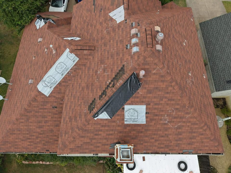
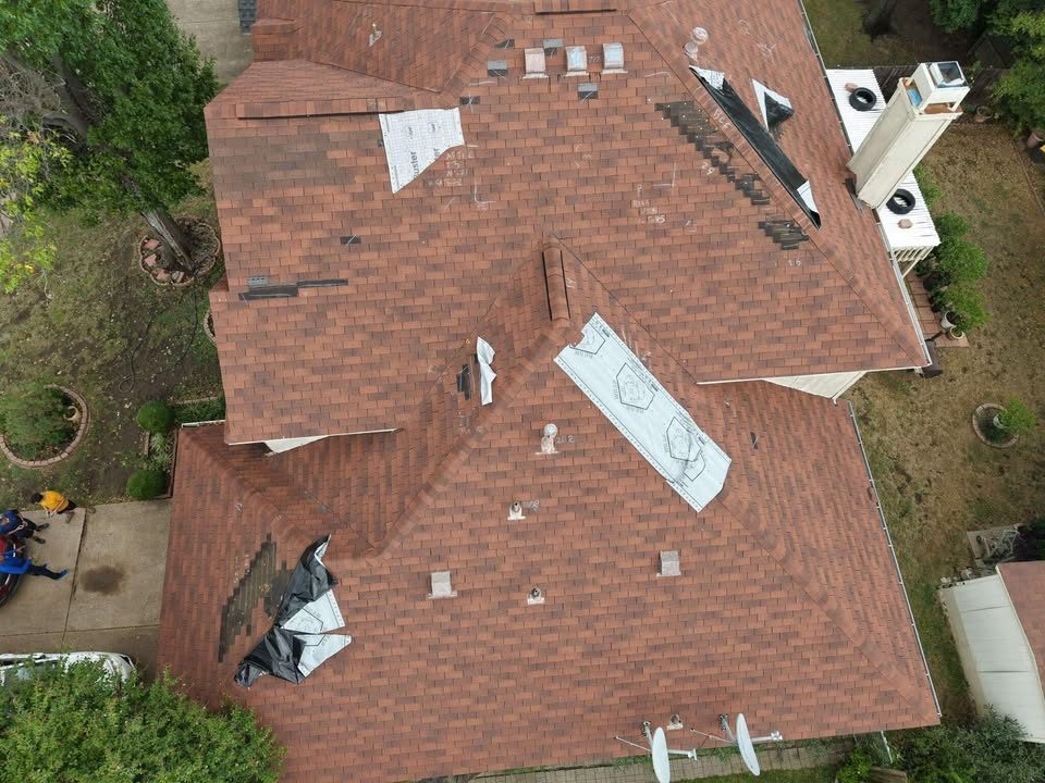
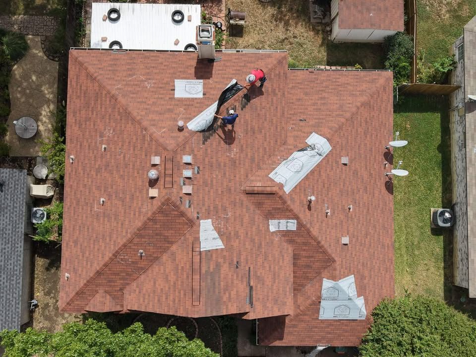
Captured with a DJI Air 3S platform (high-resolution dual-camera).
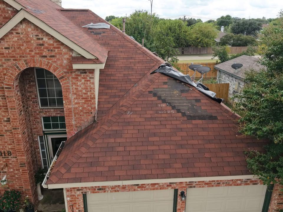
Residential, Commercial & Multi-Site Documentation
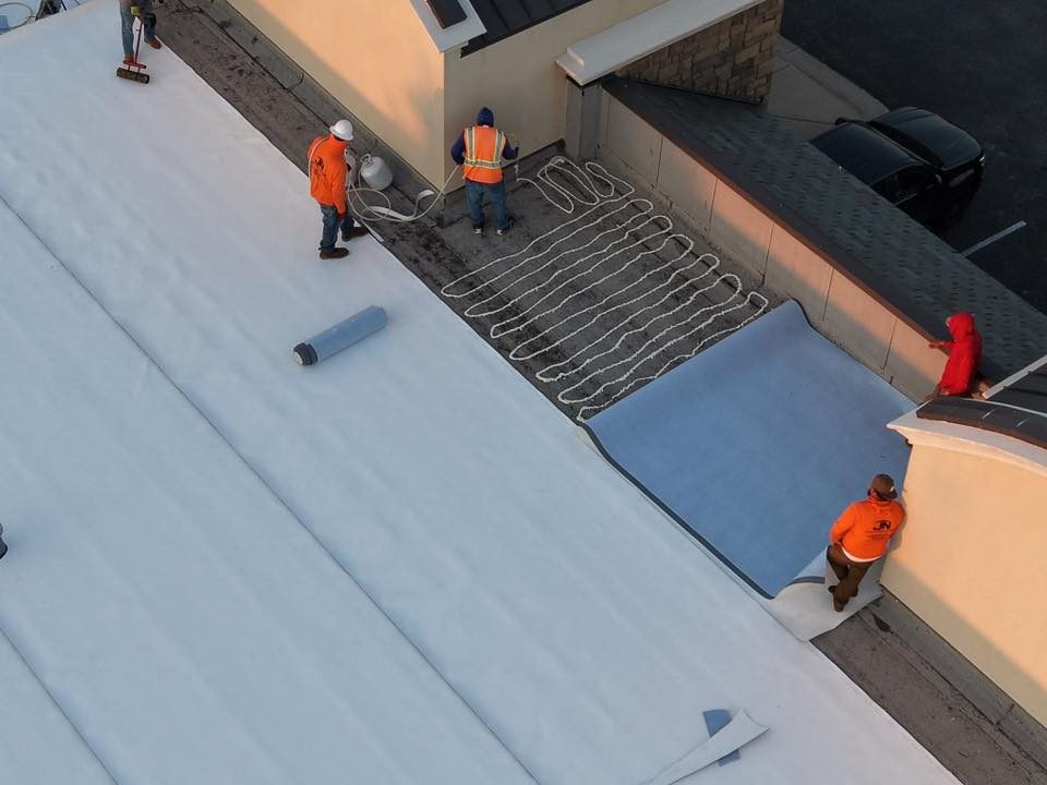
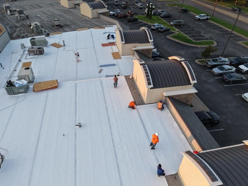
FalconSight provides aerial documentation for residential properties, commercial assets, and multi-location sites.
Common use cases include construction progress, storm or condition documentation, utility and line work, solar installations and farms, insurance support, and general asset records.
Pricing varies by site size, scope, and travel — fast, clear quotes are available before scheduling.
Most projects are quoted quickly once scope and location are confirmed.
Deliverables built for Xactimate
Most partners want consistency more than quantity. We capture predictable angles, label the important areas, and deliver a file set that your office can upload immediately.
Clean photo sets
- Sharp, level, consistent framing
- Overview + detail shots (ridges, valleys, flashing, penetrations)
- Optional marked-up highlights
Organization
- Folders by elevation / roof section
- Consistent naming for quick sorting
- ZIP download or share link delivery
Fast turnaround
- Standard delivery: 24-48 hours
- Rush options when scheduling allows
- Re-inspection / follow-up documentation available
Folder structure (example)
/01_Roof_Overview
/02_Slopes_Closeups
/03_Elevations
/04_Details_Flashing_Vents
/05_Map_(if_added)
Want your internal structure? We’ll match it.
Naming convention (example)
S1_NorthSlope_RidgeCap_01.jpg
S1_NorthSlope_Valley_02.jpg
ELEV_Front_Overview_01.jpg
DETAIL_Flashing_Chimney_01.jpg
Consistent names = faster sorting and fewer office questions.
Scope factors that change the quote
- Roof size, height, pitch, and complexity
- Access constraints, obstructions, and surrounding hazards
- Weather windows and airspace limitations
- Travel distance, multi-stop routes, and urgency
How it works
Simple workflow built for busy contractor offices: request, capture, deliver—no back-and-forth.
1) Send the address
Text or email the property address and what you need (photos, video, mapping add-on).
2) We capture safely
Aerial documentation with consistent angles and tight tele detail—no climbing required.
3) You get a clean file set
Organized folders + labeled images so you can upload to Xactimate and move fast.
Packages
Pricing is shared directly with contractors and claims partners on request. We quote by scope and deliverables.
Basic Photo Package
- Overview + detail photo set
- Labeled images
- ZIP/share link delivery
Photo + Video Package
- Expanded photo set
- Short aerial video clip(s)
- Labeled highlights
Re-inspection / Follow-up
- Targeted photo documentation
- Before/after comparisons if provided
- Fast delivery
Mapping add-on (when requested)
Best for commercial properties, multi-structure sites, and progress tracking when you need an overhead layout or measurement overlays.
Orthomosaic & Measurement Overlays
Deliverables can include an orthomosaic/site overview and basic measurement overlays for planning and documentation.
- Orthomosaic/site overview (when requested)
- Area/length measurement overlays
- Progress photos matched over time
Note: Mapping outputs are informational and not a replacement for licensed engineering or survey work.
How we run jobs
Simple process so your team can deploy us without friction.
-
Send address + scope
Property address, roof type, and any must-have shots (e.g., ridge caps, vents, valleys, flashing, gutters, collateral).
-
We capture and organize
We fly within FAA rules and weather windows, then curate the image set for clarity and consistency.
-
Delivery to your workflow
Share link or ZIP file. Labeled images for fast review and simple Xactimate upload.
Pricing is shared directly with verified contractor and claims partners on request.
Fast quote (contractors)
Quick intake so we can reply with availability + pricing sheet access. No back-and-forth.
FAQ
Can you fly steep or unsafe roofs?
Yes. Drone capture reduces ladder time and improves safety. We still respect access and airspace constraints.
Do you work outside Oklahoma?
Yes. We primarily serve Oklahoma and Texas (OKC + DFW metro). Statewide travel is available by appointment.